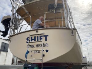
Day One: Tuesday Oct 20,2020
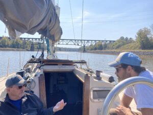
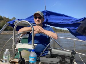
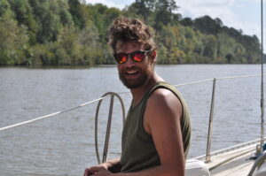
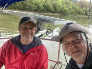
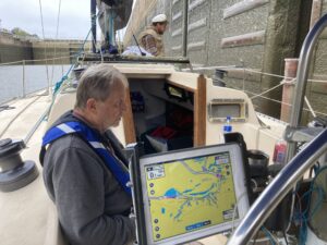
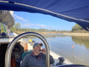
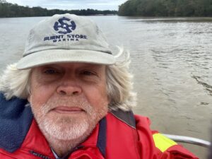
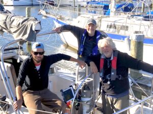
Tired but charged with anticipation, Robbie, Nelson Miller and I cast off the lines at 10 am only to discover our GPS was not syncing with Navionics hampering our ability to navigate. Determined to press on as a police boat passed on our port side, Robbie ‘Googled’ the flashing lights on the GPS and shortly found the solution, our equipment was uploading and being updated.
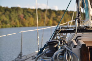
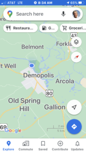
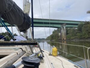
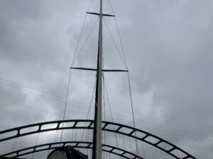
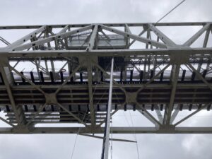
Our biggest issues are bridges, locks, water levels, anchorages, fuel, navigation and Weather. We have a 50′ mast to be tested.

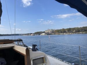
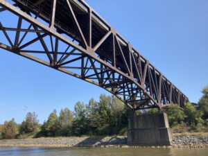
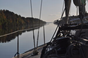
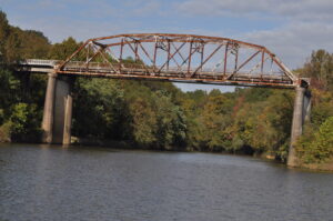
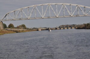
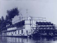
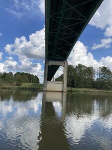
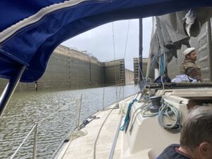
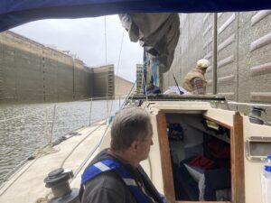
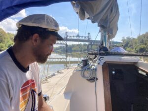
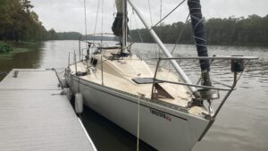
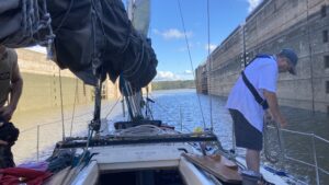
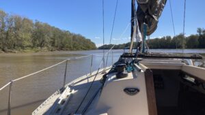
Pass Grand Marina and enter Tennessee Tombigbee Waterway MM 450. All is new and a real adventure beginning, one I have been planning, and working towards for 6 years. We will descend from an altitude of 450 feet down to sea level, traversing 12 Locks and crossing under 32 Bridges. Some would prove challenging.
All the waterways are separated into Pools with their own water levels. Pickwick was 2’ below pool so clearing the first 4 bridges was easy.
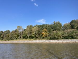
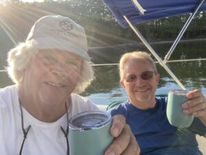
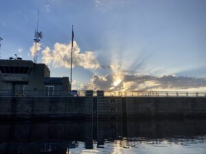
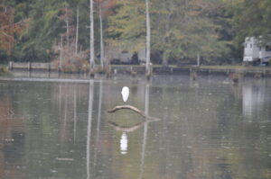
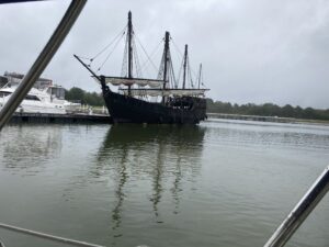
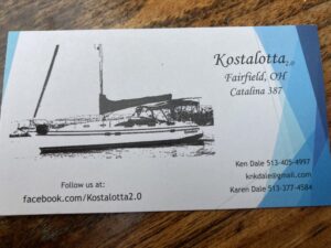
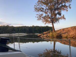
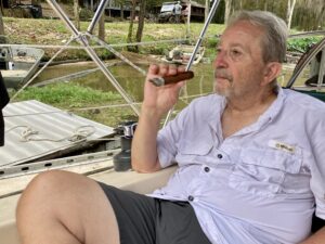
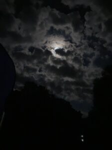
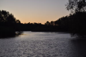
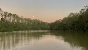
We anchor in beautiful Bay Springs Lake with beaches to our side. There is one other sailboat there named Kostalota. Funny name until you say it. We discuss leaving in the morning at 8.30 to travel and lock up with trawlers. For dinner we have pre-prepared jambalaya that Sue made. Having at least two frozen dishes made life easier. Rusty Nails, Bellaterra Cigars and a dinner made for a good night sleep. There is new moon waxing with Jupiter, Saturn and Mars all visible. Find Cassiopeia. Venus is rising.
Day Two: Wednesday Oct 21
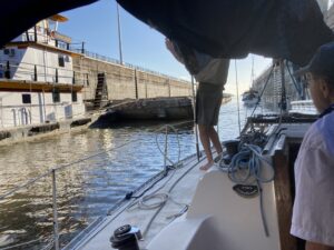
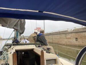
The sun rises on a beautiful day. We awoke early and cast off at 7 am leaving Kostalota. Kostalota caught up with us for the first lock. There were two trawlers who wanted to lock through with us but missed the window. Lock through our first lock of six for the day. Tom Garrison prepares us that the first 52′ bridge is a butt tightener but good to go after that is passed. We will see!

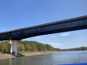
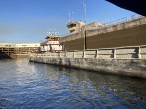
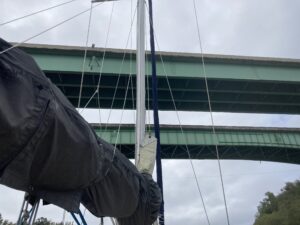
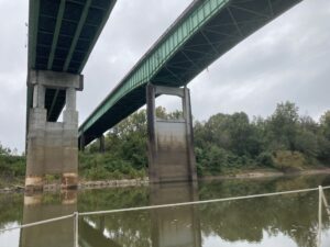
A word about Locks and Bridges. Between the head water and tail waters there are Pools. Headwaters are immediately upstream from a dam and tail waters are downstream from a dam. While the Pool level often stays constant it can change and affect bridge clearance. We were about to learn this the hard way. Some charts will read Vertical Clearance at Ordinary High Water and others read Vertical Clearance at Pool Stage. Big difference.
Best advice is to radio barge captains and lock masters to ask about water conditions. Other sources are:
http://maps.waterdata.usgs.gov/mapper/index.html
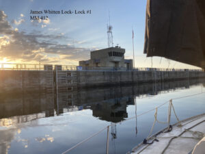
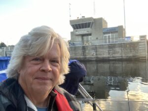
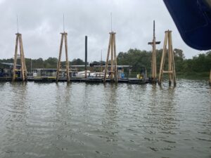
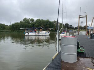
First Lock is James Whitten at Bay Springs. Kostalota tries to inform of us the correct way to tie off to bollards (called pins by lock master). We discuss his profession. Turns out he is an engineer and a new boater.


Perfect weather even a little hot. All systems appear to be working. Robbie spends most of the day organizing galley and dual refrigeration. Frozen gallon jugs are essential.
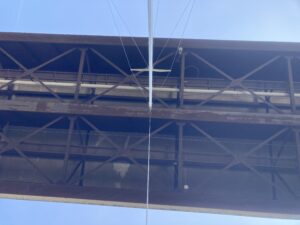
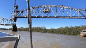
We scrapped a bridge with our wind chicken at mm 410.7 listed at 53’. Pool E.
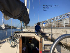
Second Lock through at Montgomery Lock to Pool D. MM 406
Third Lock is Rankin Lock at MM 398.4

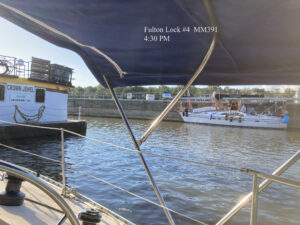
Fourth Lock is Fulton Lock at MM 391.

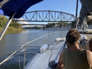
Twin 52’ bridges no issues.
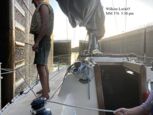
Fifth Lock is Wilkins Lock mm 376. Windy is the lock master and sweet. Everyone loves Windy. She locked us in with a barge and Kostalota which is unusual to share a Lock with a barge. Race to next Lock and get through.
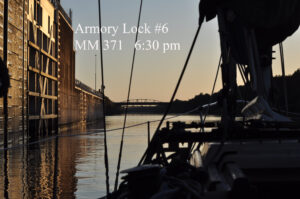
Sixth Lock is Armory Lock at mm 371
Mm 370 53’ Bridge No problem.
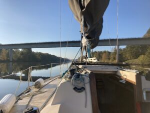
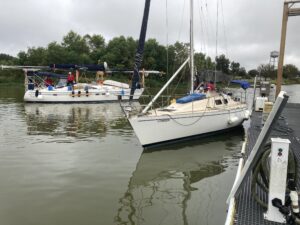
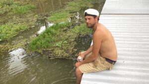
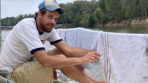
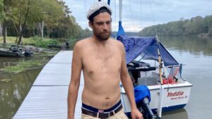
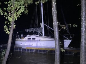
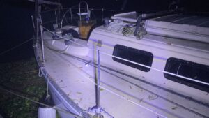
Mm 370 52’ RR bridge. Mast light hits bridge as we slowly approach. Pool was up only 4-6”. Should have had room. We discuss options with Kostalota perhaps healing and rafting. We decide to go to far left. No speed and current drifts us on our beam going under bridge. Ever so slowly we approach. It is getting dark and we are running out of options. Wind chicken hits and falls off. Anchor light touches again. Lense pops off but bulb stays. Robbie catches lense. Shew buddy! Small price to pay to keep going. We cleared another 53’ bridge. It was getting dark and we hammered down till after dark looking for any cove deep enough. We found one around MM 364 and rafted up with Kostalota in Aberdeen Lake. Great night but exhausted.
Day Three: Thursday Oct 22
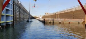
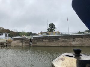
5 more bridges and 2 locks, Lock 7 Aberdeen Lock and Lock 8 Columbus ‘Stennis’ Lock.
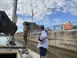
Aberdeen Lock #7 MM 358


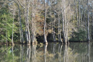
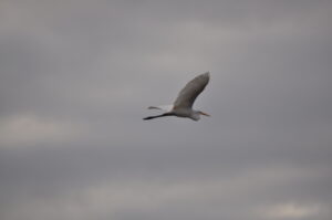
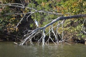
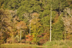
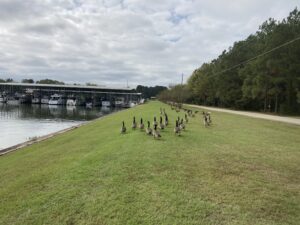
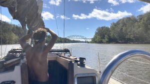
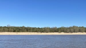
We have traveled about 100 miles south and can start to see different vegetation and birds of all kinds.


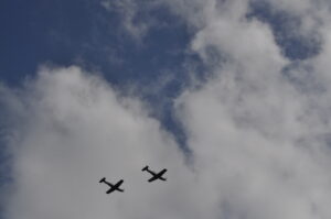
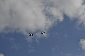
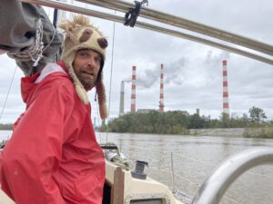
We begin to see what appears to be WWII plans flying all over. Turns out we are near the Columbus Air Force base located 9 miles north of Columbus Mississippi. It provides specialized undergraduate training for U.S Air Force.
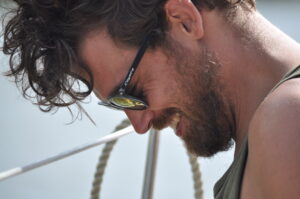


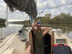
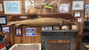
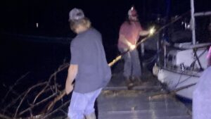
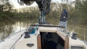
After catching the wind chicken and anchor light lense Robbie shows off his catch.
Columbus Lock #8 MM 335
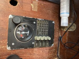
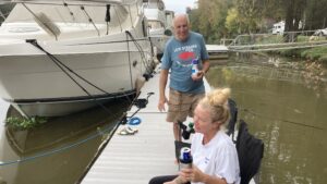
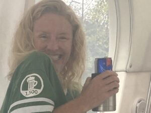
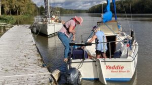
Anchor in Aliceville Lake just before another 52’ RR bridge. Arrived about 5.30 and rafted up with Kostalota. I realize there may not be enough fuel to reach Demopolis. Started with a full 30 gallon tank and at half traveled 120 miles. There are 120 miles more to Demopolis and the only marina left closed 5 years ago. Ken and Karen Dale offered us 5 gallons of diesel and we accept. Nelson graciously covers the expense. Salad for dinner with JJ Cale music. Rusty Nails and Bellaterra cigars. A perfect evening. Ice getting low and cracked open a frozen gallon jug. Sleep like a baby and did not have to listen to debate.


Day Four: Friday Oct 23
Up at 6 for coffee. Cast off about 7.30 clear first 52’ Bridge no issue and clear Lock 9 Tom Bevil Lock. We have a pretty good system of looping off to the next to last PIN on the starboard. Heading for Demopolis Lake. Lock master gives us a lesson on Snagboats a ship on the shore and the Tom Bevill Lock and Dam Visitors Center, an authentic reproduction of a mid-nineteenth Century plantation house surrounded by extensive lawns with scattered rows of shade trees. Adjacent to the U.S. Snagboat Montgomery.
Snagboats removed snags, underwater trees, stumps, or branches that created obstructions to river navigation.
A large grapple or clamshell on the snagboat’s boom pulled these obstacles from the river.
Daily operations removed approximately 120-170 snags per day!
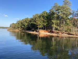
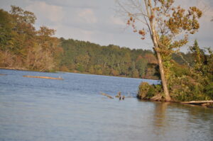
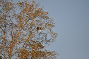
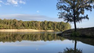
Gainesville Lake is beautiful and we saw two bald eagles land it tree.
Again fabulous weather. We are running low on drinking water and tank water. Tons of food. Only one lock for the day Gainesville Lock at MM 264.

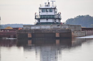
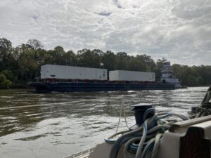
Barge Captains have their own form of communication. To pass port to port going north and south you ask for permission to pass on the one whistle and starboard the two whistle. They are always polite and engaging if requested.


Find an anchorage and raft with Kostalota (Ken and Karen Dale) using stern anchor. Rough. Accidentally pull out transponder on depth finder.


Day Five
Saturday Oct 24
Great weather. Lock 10 Gainesville Lock. Next to last lock before Coffeeville and tidal waters. Lockmaster was a pill. No pool info. Likes jokes.
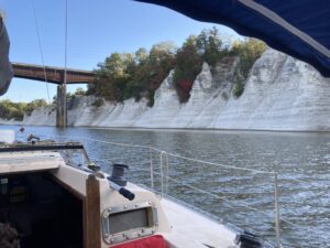
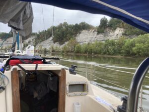
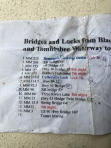
Beautiful scenery. White cliffs. Arrive in Demopolis, Alabama early afternoon. This will be the first time we stepped foot off the boat in 5 days. After a while the time passes so easily you hardly realize you are on a small boat going down a big waterway. Many referred to portions of Waterway as a ‘ditch’ but we found it all fascinating. Having a ‘cheat sheet’ with all the bridges and locks was invaluable. And having two of everything (first cheat sheet blew overboard) is very important.
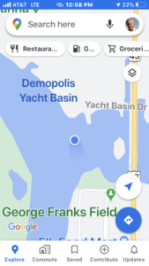
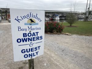
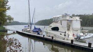
One fuel dock. Kostalota gets stuck. Wench off. Arrive Kingfisher Bay Marina where Anna Marie is dock master. She is a pill. Courtesy car to Walmart and liquor store. Fix depth finder. Storm hitting Mobile Wednesday so we are hanging here to see. Demopolis is a major stopping point for Great Loopers and boats traveling south.
Day Six: Sunday Oct 25
Great night sleep. Awoke with a new plan to wait in Demopolis until Tuesday. Maybe hit rain along the way but arrive Mobile on Friday with beautiful weather. Looking forward to experiencing marina life.

Consult Zyg and Tom about weather and change plan to leave Monday and wait out worst of storm at Bobby’s Fish Camp.
Hurricane Zeta appears as though it is just sitting in Gulf.
Sue has an unexpected visit and very sweet.


Nelson and I walk to boat yard. Meet Sean on Island packet. 
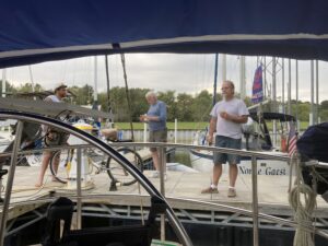
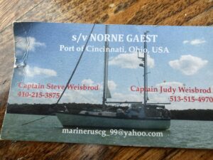
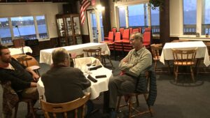
Hamburgers and new friends. Captain Steve just across on Norne Gaest has a fascinating Russian story about escorting royalty. Marina life is good but it is time to press on.
Day Seven: Monday Oct 26
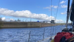
Mm214 depart 7:45 Lock 11 Demopolis Lock at 8.30 Temp 59 overcast Gloomy.
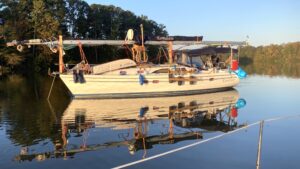
Turned out to be a beautiful day. Lock master was surly and bad information leading me to believe the water was 3’ above pool. Call another Lock master who said to talk to barges. Between Zyg, Tom and barge realized 52’ bridge was 65′. Cool railroad bridge 3-4 barges. Only one other boat. Anchored in beautiful cove Bashee ‘Batshit’ Cove mm145. 70 miles today. Only one other small sailboat in the Cove.


Day Eight: Tuesday Oct 27
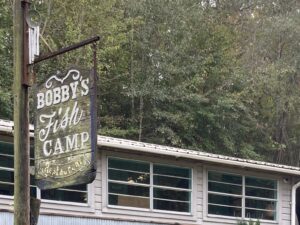
Two women in a sailboat motor by this morning on the way to Bobby’s Fish Camp. We have heard mixed reports about the Camp and closing of restaurant. Nelson gives lesson in pressing coffee and getting rid of pockets. Pull up anchor 8.30. Overcast and cool. Storm is moving fast. Drinking Bloody Mary’s, smoking cigars, listening to JJ Cale and have two sailor women in sight.


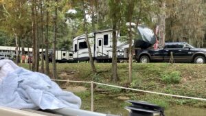
Pass the women and get to Bobby’s Fish Camp dock. Red neck paradise. Dock space for 3 boats. Nice restaurant but closed for food. RV Park as well with Trumper’s.
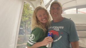
Women sailors come over with chairs for social hour. Judy and her aunt Sandra are in their 50′ and 70’s. They are in a 20’ sailboat with no toilet. They have traveled in their sailboat from Minnesota. Ray and Melissa are another couple in a crusier from Chattanooga in a crusier. Cook steaks and pork chops.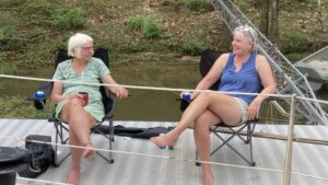


Day Nine: Wednesday Oct 28
We all wake up early sweating and mosquitoes. Rain should start soon.
Hurricane Zeta strengthened to a Cat 2.
We have tied down anchors, wrapped sails, took off Bimini. Removing everything from deck. Securing below.
Robbie may stay on board and Nelson and I in a cabin. Tied boat w many lines. Waiting for storm at Bobby’s. Storm predicted hit at midnight and possible gusts to 65mph
Judy Sandra Ray Melissa
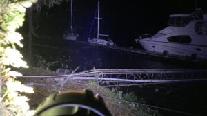
Trees down at dock walking around w spotlight. Rednecks clearing trees. Storm passed at midnight and go to bed.


Day Ten: Thursday Oct 29
Not sure if we should leave. Skies are clear but cannot reach lock master. Ray and Melissa as well as Judy and Sandra have left. Finally reach lock master and decide to leave in a hurry. Robbie has gone for a walk to everyone joins in calling him. Current ripping. Boat not sounding or acting right. Debris all around Shadow.


Coffeeville Lock #12 MM116 Tidal waters from here.


Call Tom Garrison to ask about white smoke coming out of the engine exhaust. You do become tuned to your boat and this was not right. He thinks it is just steam. Look at gauges again and we are over heating. Robbie says it smells bad near the engine. We have just cleared the last lock and the current is running 3-5 knots. We decide to anchor just outside channel markers. Anchor just holds as we go into shore. We discuss Robbie going overboard to clear filter. I lift off engine cover, open seacock and no water comes in. Clear debris in metal screen. No luck. Robbie has the idea to suck water out of a bucket and force it into the thru hull. IT WORKED. WE WERE CLEAR AND READY TO GO.


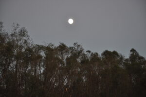
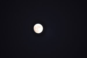
Anchor 3 rivers beautiful cove just as moon rising.
Day Eleven: Friday Oct 30
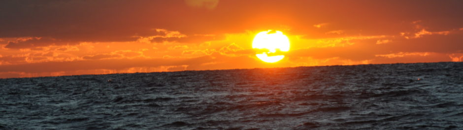
Awake thinking we can make nearly 80 miles. Leave at first light. Starting to see palms and pelicans. Lots of winding rivers. It is cold to the bone and we all have to use all our cold weather gear.


Pass MM 12 where most wait before crossing to evaluate winds and crossing into big water. Mobile Bay is windy and choppy, hard to read chart to find entrance to Dog River and cross under final bridge at Hwy 10.
We have yet another railroad bridge to have lifted but no one answers our calls. Finally it is raised.


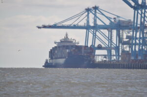
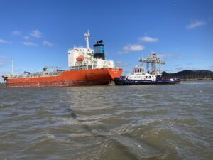
Mobile is an enormous shipping corridor. A shock after 11 days of river travel.


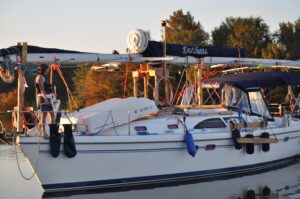
We arrive at Turner Marina and greeted by Tom Garrison. What a welcomed relief!!!


We have our final meal at Mobile Yacht Club.


Day Twelve
Saturday Oct 31
Awake 6 am and start cleaning and getting ready to go. Sue meets us and we drive home exhausted but happy.
In review, we had the best crew. We worked well together, we discussed everything under the sun. We solved important questions. We ate well and were moved by great music. We met some interesting people. Had good counsel for traveled sailors. We did not have one cut, scrape or bruise. We survived hitting a bridge, a brush with a hurricane, solved an over heating engine in the middle of a turbulent river and navigated over 450 miles to Mobile Bay. Dreams can become a reality.